Surrey Hills- Climbing Mini Mountains in Little Switzerland

There's a place that I visit a lot. It has ancient woodland, diverse wildlife and a rich and complex history. A maze of footpaths make their way through pine, oak and birch as they lead to escarpments with far reaching views. Flora and Fauna are around every corner and they change with the seasons like I've seen nowhere else. There's so much to see that a lifetime of walking here could never be enough. Some parts feel as though you're working through a Caledonian forest or a Robin Hood film set. Most days you walk for miles without seeing another soul and the only noises are those of nature. Sounds nice right? Well it is. But, one of the most amazing things about this green idyll however, is its accessibleness. This stunning location is on the doorstep to 8 million people. Yes, only 25 miles from London, but you wouldn't think it when you're in the wild heart of these wooded hills.

I'm talking about a little part of the Surrey Hills affectionately known as 'Little Switzerland'. Its home to the highest point in Surrey and the second highest in the south-east. Luckily for me, these hills are just down the road. However, even for the most urban of city dwellers, it's just an hours train ride from central London*. Recently, I've been getting to know this area just a little bit better by revisiting three of 'Little Switzerland's' highest hills. Pitch Hill, Holmbury Hill and Leith Hill.
These three hills form part of the greensand ridge that runs all the way from Surrey to the edge of the Romney Marshes in Kent. Much of this ridge is densely wooded with scots pines and birch that grow in the poorer soils, to oak and hazel that grow in the richer soils. There is a long distance footpath (The Greensand Way) that follows this sandy ridge the entire 110 miles. For anyone looking for a shorter walk however, there are plenty of day walks and trails that you can tailor to your own ability.
Pitch Hill
Pitch Hill stands at a very modest 257m. Starting from the village of Peaslake, a quiet little village tucked away in the trees, I begin by walking past the tiny little village church and straight into the woods. Within minutes I'm on a sandy track amongst the pines. This is a good introduction to what its like to walk on these slopes. Pine woodland that stretches into the distance. Column after column, all perfectly straight and evenly spaced. Much of this area is used for forestry and the fast growing pines are the perfect trees for the sandy soil. Its a very steady climb to the top of Pitch Hill when coming from the north. So gradual in fact that you barely notice you're climbing at all. There's only one (relatively tame) incline just before the top to contend with, before popping out at the lookout point.

Some lookout it is too! Its a real treat after spending your time hidden in the woodland, when you're greeted with an expansive view like the one at the top of Pitch Hill. The views across the Low Weald, towards the South Downs in the distance are the perfect contrast to the dark interior of the woods. Even though Pitch Hill's height isn't going to give the worst Acrophobia sufferer trouble or anyone altitude sickness, its location in front of the flat, low lying Low Weald means it feels higher than it is. Looking over my left shoulder I can see the next stopping point on my walk. But, I stop a while on one of the convenient benches facing Sussex to appreciate the view.
Holmbury Hill
After admiring the view, I head towards the next mini mountain of the day, Holmbury Hill. Both Holmbury Hill and Pitch Hill form part of an ancient wood known as the Hurtwood. The Hurtwood has a fascinating history that stretches back to before the Romans. Much of the Hurtwood is part of the ancient Shere manor estate which has remained in the Bray family since being given to Sir Reginald Bray by Henry VII in 1485. The land is now carefully managed by the 'Friends of the Hurtwood', a charity who work with the many landowners of the Hurtwood to maintain this unique place. But, way before Sir Reggie got his hands on it, the Hurtwood was the site of an Iron Age hill fort on top of Holmbury Hill.

To climb up Holmbury Hill from Pitch Hill you just need to follow the Greensand Way through a charming little valley. First passing through the Duke of Kent School, and then a beautiful farm with paddocks, sheep and cows. It provides a quick break from the woodland that soon engulfs me again at the foot of Holmbury Hill. Continuing on the Greensand Way leads right to the top of the hill fort.

Stepping over 2500 year old battlements, still visible after all this time, there's a similar (but no less spectacular) view as the one at Pitch Hill. Its easy to see why this spot would be chosen as a hill fort. Commanding views to the south even allow you to see a speck of the English Channel on a clear day. From this spot, nearly 2000 years ago, I would be able to see Romans making their way up and down Stane Street -the Roman road from Chichester to London. This alone would have made it an important spot. With my mind well and truly boggled at the thought of all the history that had unfolded beneath my feet, I set off for another spectacular spot.
Leith Hill
I'm now heading for the highest point in Surrey. At 294m its the Matterhorn of 'Little Switzerland'. Okay, so its not the highest hill in England, but its views are equal to Holmbury Hill and Pitch, with a history that could rival any other.
Countless scenes and stories have unfolded in this area of the Surrey Hills and some of the most interesting happened on the slopes of this very hill. A Saxon army, led by Alfred the Great's father -Aethelwulf of Wessex- are said to have defeated the Danes, who were on their way to sack the old capital of Winchester, right on this hill. Perhaps one of the most famous visitors to Leith Hills slopes, however, is Charles Darwin. The naturalist's eldest sister, Caroline Wedgewood, lived at the nearby Leith Hill estate and Darwin would walk in the surrounding woodland. The National Trust own much of the Leith Hill estate, including the Rhododendron wood planted by Caroline in the late 1800's. She, like her younger brother, knew her peonies from her pansies.
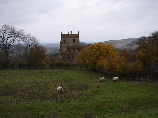
Leith Hill doesn't fall under the umbrella of the Hurtwood. It still forms part of the Greensand ridge, and is only separated by the small village of Hombury St.Mary's. Following the Greensand Way from Holmbury Hill will take me to Leith Hill via the village. The village is a great place stop on the walk. Well, more accurately, the King's Head pub in the village is a great place to stop. A charming country pub with a sign outside that encourages muddy boots and dogs. Not all pubs do, as I have found out! After fueling up, continuing on the Greensand Way leads me back into the woods and to the climb up to Leith Hill. There's no mistaking the summit. Its dominated by Leith Hill tower.

The tower was built in 1765 by Richard Hull- the then owner of Leith Hill Place. The very top of the folly makes it the highest point in the south-east with panoramic views. Big Ben can be seen on a clear day, as well as the south coast. Now, like most of Leith Hill, the tower belongs to the National Trust. Visitors are welcome to enjoy the views from around the tower for free, but to go in and climb the 72 steps to the top is just £1.30.
Friday Street and Tillingbourne Waterfall
The next stop on the walk isn't something that you typically find in these parts. Gradually descending north, back into the woodland, I head for a waterfall. The waterfall lies just to the east of the quaint hamlet of Friday Street. Still following the Greensand Way, through damp woodlands of beech and oak, I arrive at the pretty little Tillingbourne waterfall. Its not Angel Falls, but it is Surrey's tallest. You won't need ponchos because of the spray like at Niagra, but, like everywhere else around this area its quaint, charming, modest and manicured. Although the falls are privately owned, you can still get a very good view of the small series of cascades from the footpath.

Heading from the waterfall, I make my way towards the hamlet of Friday Street. Its a small group of less than 20 houses buried in the trees. In the centre is a large mill pond. It really feels like you're deep in the woods here. A small lane with tidy cottages lead to a very lovely pub called the Stephen Langton Inn. I have mentioned it before in a previous post about Surrey's best pub walks. Today however, I won't be stopping there. I'll be making my way west back to the village of Peaslake.

As you may have gathered with this area, trees make an appearance quiet a lot. This final section of my walk is no different, and I spend much of the last section in a mix of different woodlands. For me, this never gets boring. It constantly changes between the bracken covered floors of the pine woods to the diverse and colourful broadleaf woodland. With each change of wood comes different wildlife and a different feel. It also makes it a great place to visit all year round. Its lush and vibrant in the summer, with the trees providing welcome shade from the sun. But, in the winter, its atmospheric and evocative.

The gentle northern slopes of the greensand ridge mean its a fairly level walk back into the village of Peaslake. Its always rewarding walking in these woods and hills. It always turns up surprises and never looks the same each time you go. I know there's more to learn about the history and wildlife of 'Little Switzerland'. I know there's more stories than I'll ever be able to know, but that just adds to the mystique of this place.
On Foot Note
OSMaps Route
Greensand Way- LDWA
Support the 'Friends of the Hurtwood'
Leith Hill Tower and the National Trust
* The train from Waterloo to the village of Gomshall -a descent walk or short cycle- would probably be the best route to get here

Comments
Post a Comment