Lake District (Day 2)- Great Langdale to the Roof of England

Travelling deeper into Great Langdale valley is to travel back in time. The signs of modern life diminish as the mobile phone signal disappears completely. Farms and their out-buildings look as they would have for hundreds of years, hemmed in by the great Fells above and seemingly isolated from the outside world. I hadn't been quite prepared for such a place. In the early morning sun, on another balmy day in the Lakes, it looked unreal. I had chosen this picturesque valley to be the trailhead to my days walk in which I'd ascend a selection of mountains I've wanted to climb for some time. If this is just the start of the walk, then I'm in for one hell of a days hike!
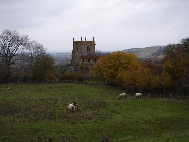
Luckily, a car parking space appeared at an opportune moment and meant I could start the walk from exactly where I wanted- parking in the valley is either limited or expensive it turns out. After applying copious amounts of sun block and filling up every water bottle I had, I marched along the rest of the valley, aiming towards the dead end of rock in front of me which would be my first ascent of the day. Just before I started heading upwards, I passed through a beautiful farm at the valley's foot. Stool End Farm, a beautiful old mountain sheep farm which would be the last outcrop of human activity before the wilderness of the Fells and mountains began.

My first aim for the day was the summit of Bowfell. At 902m its one of England's highest peaks. Wainwright put it in his list of 'finest half-dozen', which gave me two great reasons to add it in the days walk. But before that, I had the tough climb from the valley bottom. To get to Bowfell from Great Langdale, I chose a path that would lead me up 'The Band' and past Earring Crag. This was a tough climb. After the previous day, ascending two sizable summits, my legs were certainly starting to feel it. I tried to fool myself into thinking that once I got up to Bowfell, the rest of the walk would be along ridges and include just some short ascents to the tops of each summit. Even I wasn't buying it! With every step, the sun was getting stronger. The consolation to all this however, was the view of course.

Stopping to look back as I ascended, Great Langdale got more impressive with every step upwards. With the famous Langdale Pikes on one side and Crinkle Crags the other, it was hard to concentrate on where I was going! After progressing 2000ft in just over 2 miles, I reached the saddle I was aiming for. The three small tarns in front of me confirmed I was at the right spot to make the last rocky scramble to the summit of Bowfell. The views were no longer limited to one side and the wonderful panoramas had begun.

I found myself alone at Bowfell's summit, which surprised me. For some reason I imagined there would be at least a few eager ramblers seated at it's stony summit. Being alone on a wild and well known peak like Bowfell was a pleasure. As crowded as the Lake side towns of Keswick and Ambleside may feel, it appears that there are still plenty of places in the National Park for solitude. I stayed a short while to admire the view, but there were three more peaks calling me over, all of which I could see from this spectacular spot.
I would now head for Esk Pike. Its Bowfell's close neighbour and only about 1km to the north-west. While making my way down from Bowfell was relatively easy going, I can imagine in bad weather you could easily become disorientated. The use of a map and compass is imperative as paths disappear under boulders and scree. Today though, I could see the pike that I was aiming for. A short trip over 'Ore Gap' (the saddle in between the two peaks) and I was sat atop another Wainwright*. The view, although similar to that of Bowfell, brought Scafell Pike more clearly into focus. Before I became the highest person in England however, I would follow the natural horseshoe around and do a slight detour up Great End.

A fantastic name for a fantastic mountain. Viewed from the north, Great End is a wall of seemingly impenetrable rock. But, coming from the elevated approach to the south, it seemed more rounded and less imposing. Its softer side. I sat on the summit of Great End, polishing another bottle of water off, wondering where all the walkers are? I not only had Bowfell to myself, but now shared Great End with absolutely no one. Was there free Kendal Mint Cake being given out somewhere that I didn't know about? A new tea room open perhaps? Or maybe, I should just enjoy the fact that I had this iconic spot all to myself.
It wouldn't be long before I realized where all those ramblers had been rambling however. I remembered that for some reason, most of us have a compulsion to climb the highest thing around. Not the most beautiful. Not the most pleasant ascent. But the biggest. Number 1. All these missing ramblers would be at the top of Scafell Pike wouldn't they?

As I left Great End and headed for the cloud covered Scafell Pike, my theory was confirmed. On the path that makes its way between Broad Crag and Ill Crag to Scafell Pike's summit, more and more people came into view. They reminded me of pilgrims. All making their way to the Mecca of walking. People would begin to filter in from the adjoining paths, all to have a moment of being the highest person in England. I can't deny that in some way, I'm one of those people. I consider myself quite an avid walker. I've walked in great parts of the country and seen some immense views. But, for some bizarre reason I felt I needed to tick this top off the list. Not logical, but, as it turns out, completely worth it.
After picking my way over the boulders while following the cairns that signalled the way to go, I climbed the last section up to the roof of England. Atop Scafell Pike sits a small platform. A few steps up and I was the highest person in the country! Well, I was once I had waited for a particularly tall Dutch couple get down from the platform. I quickly stepped down to give others the chance to have a photo at the summit and high five their fellow pilgrims, then snapped a few photos of the trig point and took a moment to look around me.

Like everywhere in the lakes, the scene in front of me was stunning. Not wanting to add to the crowds on the summit, I began to descend. I was heading for a path called the Corridor Route. So, I made my way down Scafell Pike as tourists from all over the world were heading up. Spanish, German, American and French could all be heard as I passed- probably all saying 'are we there yet?' in their own respective languages. With the Lake District recently being made a UNESCO world heritage site, I imagine Scafell Pike will see more and more visitors year on year.
The Corridor Route hugs the base of Scafell Pike, Broad End and Great End in the valley bottom. I was walking along this route up to Sty Head tarn, where I would head east towards my finishing point, back at Great Langdale. The Corridor Route was the perfect contrast to the previous half of the walk. Where I had been looking out over expansive vistas as far as the eye could see, I now found myself craning my head upwards at the giants I had been stood on. The route crosses dramatic Gills that carve their way down the mountain and offers views of Great Gable that stopped me in my tracks. The most popular route up Scafell is to ascend via the shortest route from Wasdale Head. But, if you have the time, taking the Corridor Route from the Borrowdale valley- or even starting at Wasdale head and then meeting up with the Corridor Route- would give a quieter and more diverse way up. Of course, I can now fully recommend the route explained here from Great Langdale as a brilliant, yet difficult option.

A little way along the Corridor and I found myself on my own again. At least except for the odd Herdwick sheep here and there. I take my hat off to those hardy balls of wool for being able to survive out here. Not so difficult on a day like today, but you don't need much imagination to picture what it would be like in unpleasant weather.
Once I could see Sty Head tarn, I took it as my cue to take the next path to my right- carrying me back towards my starting point. This stretch of the walk would be easily navigated as it was very much a straight line back to Great Langdale. Luckily for my legs, this section of the walk was mostly level...ish. The last section of the walk didn't disappoint either. With two more tarns (Sprinkling tarn and Angle tarn) and the great end of Great End to look at, I was quite content.

Dropping back down into Great Langdale on jelly legs, I was treated to the stunning view of the valley without having to keep turning around this time. I met up with the Cumbria Way (the 70 mile pathway travelling the length of Cumbria) for a few miles before dropping onto the road to return to my car.
The Southern Fells in which I had spent the majority of the day felt wild and a little intimidating. More akin to the Scottish Highlands than anywhere else in England. Once into the rocky interior of the national park it showed me another face of Lakeland. Gone were the chocolate box pictures of Dove Cottage and Hill Top farm, instead replaced with mountains and the full forces of nature. Driving back through the valley and returning to the 21st century, I felt somewhat pleased that I had chosen to visit this area and stand on the roof of England at 978m. Not necessary or logical, but definitely worth it!
On Foot Note
OSmaps Route
* The Wainwrights are the 214 fells (hills and mountains) described in A. Wainwright's seven-volume Pictorial Guide to the Lakeland Fells
List of Wainwrights
Cumbria Way LDWA (Long Distance Walkers Association)
Great Langdale National Trust Campsite
Walklakes.co.uk:
- Corridor Route
- Bowfell

Comments
Post a Comment