The Black Mountains- Waun Fach and Pen y Gadair Fawr

Most people don't consider getting up at 5 o'clock on a day off as an all together sensible, or indeed, sane thing to do. Neither would they consider following that with a long hike in the mountains as a particularly rational thought either... So, I bounce out of bed at 5:01AM with great anticipation as I'm all set for a days walk in the Black Mountains of South Wales.
The Black Mountains extend from the Usk Valley in the Brecon Beacons to the English-Welsh border with Herefordshire. A blend of peaks, plateaus and wooded valleys combine to make a fantastic place to walk. Like much of the Brecon Beacons, the hills are of the distinctive Old Red Sandstone topped, with a mix of grass and heather. After visiting the Brecon Beacons relatively recently (A Break In The Brecon Beacons) I'd gotten hooked on this wild landscape and couldn't wait to explore the remote region of the Black Mountains around Waun Fach.
Waun fach (811m) is a rounded summit surrounded by other subsidiary peaks that are more distinguishable, and actually look higher. The plan for my walk is to ascend as many as possible in a comfortable amount of time. I had mapped a looped route that managed to hit the neighbouring tops of Pen Y Gadair Fawr (800m), Pen Allt Mawr (719m) and Pen Cerrig-Calch (701m)- among a few less prominent peaks.

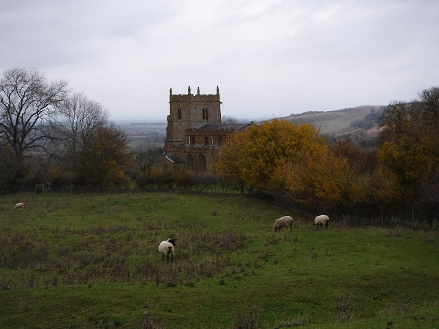
I began by parking in the Vale of Grwyney, just north-east of the town of Crickhowell. Once through Crickhowell I drove along narrow roads lined high with hedges, towards where I'd park my car. Its not the sort of road that you want to meet a car coming the other way, but, luckily this is a quiet place that sees a lot less visitors than other regions of the Beacons. Actually, the Black Mountains were splendidly, if not eerily, quiet. After recently climbing Pen Y Fan- the highest mountain in Southern Britain- with what I can only assume was the population of Wales, I anticipated some of those people would also want to climb the 2nd highest, Waun Fach. However, today I would only be sharing the mountains with this regions interesting upland wildlife.
Once parked, I started my route by following the llwybr troed cyhoeddus (public footpath in Welsh) over a clear stream and ascended into dense pine woodland. Starting in the valley, I knew that most of the days ascent would be towards the beginning of the walk before I climbed the first real summit. For the first few miles, I pass through woodland and farmland in glorious sunshine. The heat and the elevation made it hard work, but the paths and beautiful farmland made it worth the sweat. I knew once I got up and out of the valley, the wind would pick up and the rest of the walk would be much cooler.

The landscape around me quickly changed as I gained height. As grass gave way to heather, like I predicted, a cool wind picked up and the sunshine was dulled slightly with cloud.

One of the things that I really wanted to get out of a day in the Black Mountains was the chance to practice my navigation skills. As soon as I got high enough, I left the thinly trodden path and made my own way towards the first distinguishable summit of Pen Y Gadair Fawr.
With some elevation the true nature of this region became clear. On a relatively sunny day, the surrounding mountains and moors look stunning, if not a little imposing. Its a vast, wild and barren-looking vista that I imagine is harsh and unforgiving in bad weather or poor visibility. Today, however, Skylarks were singing and the satisfying peak of Pen Y Gadair Fawr ushered me over.
Stood on the summit of Pen Y Gadair Fawr, you'd think you were at the highest point around. I wasn't however, as that spot lies just north-west at the rounded (and some may say less spectacular) summit of Waun Fach.

The walk between the two summits was made easy by the perfectly laid path of flag stones and gravel that links them. It looked like a recently completed path and I was very grateful for it as looking to either side of the track was wet, boggy ground.
The wildlife on this section between the peaks was extraordinary. More Red Kites than I've ever seen were hunting and fighting with each other at the edge of the ridge. Being at such a height gave me the unique perspective of looking down on these magnificent birds of prey. Red Kites were once on the brink of extinction in Britain with only a few surviving pairs in mid Wales. Thanks to a huge conservation effort and feeding stations spread across the Brecon Beacons and much of Wales, they now thrive. Although a common site, these acrobats in the sky are still remarkable to watch.

At the summit of Waun Fach I took the opportunity to rest a little and take the obligatory trig point photo. With noone around for miles I'd have to take it myself.

From Waun Fach the rest of my walk was clear to see. I'd follow the ridge around and hit a few small summits before the more prominent feature in the landscape, Pen Allt Mawr.
This section of the walk began to shift my view towards the west and gave me a whole new panorama to ogle. Dotted along the hillsides I could see small groups of Welsh cobs. This hardy breed of wild mountain pony has been roaming the sandstone here since the Romans were. An impressive and stirring scene that really elevated the walk.

Just before reaching the short but steep climb to the summit of Pen Allt Mawr, my attention was grabbed by the site of seemingly random graves. Referring to the map, I see that these aren't graves, but boundary stones. Most of the inscriptions are worn away with weathering, but the date 1817 is just visible. Later investigation informed me that these stones are linked with John and Mary Macnamara, owners of the vast Llangoed estate. There are various legends involving the pair that add to the countless stories that are locked in these hills. The more I delve into the history of this area, the more intriguing and mysterious it becomes.

Even though Pen Allt Mawr is a more modest 719m high, it certainly doesn't feel it. Approaching it from the north you get a steep last 50m climb before being greeted with a trig point, hollowed cairn and one of the best views on the route.

Making my way to Pen Cerrig-Calch, the last summit on the walk, I try and take in as much as I can from the last stretch of upland on my days walk. Sinkholes, boulders and cairns scatter the summit of this final peak and the distinction between what is archaeology and natural is blurred. A pile of stones to one side of the track could have been placed there 4 years ago or 4000. Its a credit to this landscape how it fuelled my imagination the whole day. I constantly pictured these same hills in different periods of history. Wondering who was standing in the same spot I am 3000 years ago.

Descending Pen Cerrig-Calch, followed by ominous looking cloud, I'm treated to a last lookout from these lofty hills. Looking south is the iconic Table mountain that sits between Crickhowell and I. The unmistakable, flat topped iron age hill fort of Table Mountain is actually where the town gained its name. Crickhowell is an anglicised version of Crug Hywel, meaning Hywel's fort.

Back down in the valley, out of the wind, the air feels warm and humid and I'm reminded that summer will soon be on its way. Bluebells will soon be replaced with Bracken in the valleys and on the slopes. The last couple of miles along the road are far more pleasant than I expected. The road is quiet and the sound of rushing water from Grwyne Fechan accompanies me on my last short stretch to the car.
Thru-hikers and multi-day walkers might want to know about the waymarker I passed on this final stretch. The marker was for the Beacons Way. Its a long distance footpath that traverses the Brecon Beacons National Park from east to west, making the most of its wilderness areas. The full length of this footpath is 98 miles. Its route has some significant elevation gains and passes over many of the regions mountains, such as Pen Y Fan. Its a multi-day walk that I would certainly consider after seeing some of the areas that footpath passes. See the 'On Foot Notes' for more details.

Sadly, I reach the end of my days ramble. I consider the Surrey Hills where I live to be an interesting and beautiful place to walk. I enjoy its modest, human scale that feels serene and unimposing. However, I do envy those that have mountains like these on their doorsteps.
On Foot Note
Brecon Beacons- The Black Mountains
Beacons Way

Comments
Post a Comment